At ESR, our 3D laser scanning services provide high-precision digital representations of physical environments, enabling accurate measurements, modeling, and analysis. Using advanced laser technology, we capture detailed 3D data for industrial plants, hazardous areas, and complex structures with millimeter accuracy. This non-intrusive method enhances project planning, reduces rework, and improves safety by delivering reliable digital twins for design, simulation, and asset management. Whether you need as-built documentation, clash detection, or site verification, our 3D scanning solutions ensure efficiency and precision in every project.
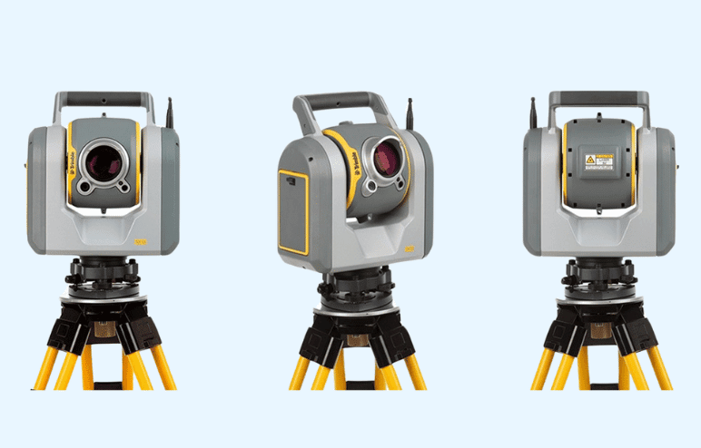
Terrestrial 3D scanning, a technology that uses lasers to capture the precise dimensions and layout of physical spaces has already shown its impact in a multitude of sectors. When employed in plant environments, this scanning technology enables engineers and managers to obtain a detailed understanding of plant infrastructure without resorting to the manual and time-consuming practices of traditional measurement methods. From intricate machinery to expansive floor plans, terrestrial 3D scanning presents an effective method for capturing high-resolution data that can be used to design, analyze, and maintain plant assets.
Terrestrial 3D scanning
3D scanning technology gathers detailed scan data, capturing the precise dimensions and layout of the plant.
3D modeling software is then used to construct a virtual representation, a digital twin of the plant.
The virtual model serves as a replica of the plant, enabling engineers to examine the infrastructure in a digital environment.
By utilizing the digital twin, potential issues can be detected early on, allowing for proactive maintenance and optimization.
Engineers can analyze the virtual model to identify areas of concern, plan modifications, and optimize plant operations.